Trail Conditions July 3rd – water and altitude sickness
Topics:
- Stage 2 fire restrictions for both forests
- Water updates
- Altitude sickness incidents
- Relevant active fires in northern New Mexico
Both forests are in Stage 2 Fire Restrictions until September 30th or until rescinded
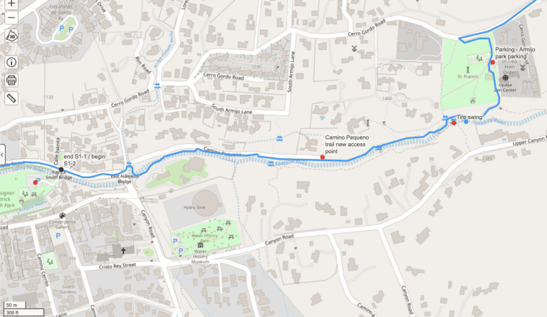
Water updates
- La Cueva Creek is dry per reports from a group of hikers and a solo hiker in the last 48 hours.
- As noted in earlier posts:
- Little Tesuque Creek is dry. Big Tesuque is still fine.
- La Cueva Lake is dry.
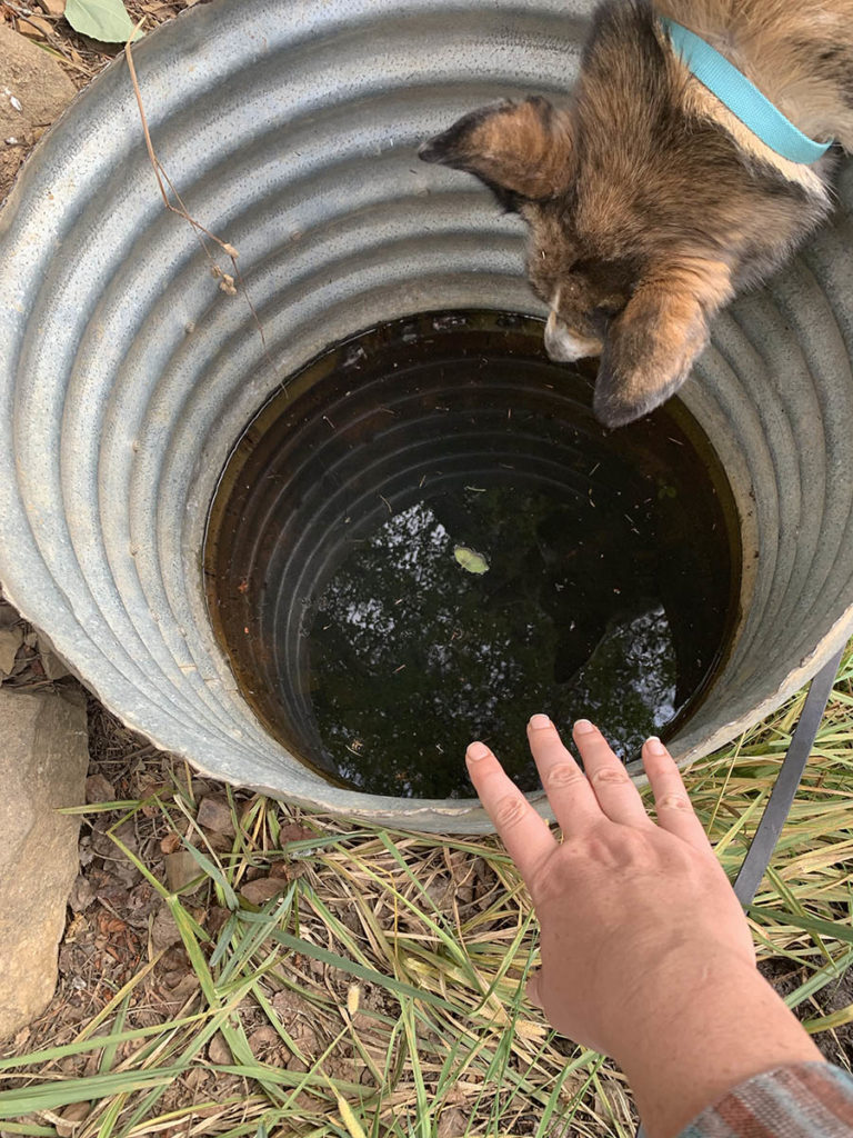
- The covered well about a third of a mile north and west of La Cueva Peak still has water. Not appetizing water, but water. Please keep the cover on.
- Note that the covered well is near the large, and largely empty, metal stock tank. The stock tank is on the left side of the track if you’re headed NOBO. The covered well is on the right side of the track, about 30ish feet off the trail.
- Some people have been put off by American Spring. Just so you know what to expect of it, here’s a blog post I wrote about it several years ago. It hasn’t changed much. If you go by American Spring, please make sure there’s a big thick stick/branch in it so the birds can get out.
- I know lots of people wanted to cut the road walking way down, but Forest Road 437 has the great benefit of being along Rio Chiquito the whole way. The beaver dams are also really cool. FR 437 is now an alternate route past Paradise Trail. The “standard” route of the SF2T goes up Paradise and west on South Boundary now. It is trail, not road, but the water situation is not great. Basically all you get is American Spring. Forest Road 437 has water the whole way.
- If you do go via Forest Road 437 past Paradise Trail, consider filling up on water before you go up into Drake Canyon, then dry camping in the “three canyons” field campsite area or higher up in the campsite area basically at the top of the Drake Canyon climb.
- Yes… dry camping. But some people (including retired law enforcement people) have had quasi-harrowing experiences with rowdy OHVers coming through in the middle of the night along Rio Chiquito right opposite of the Drake Canyon entrance. If you just go into the canyon a mile or so, you can avoid that.
- Someday I would love to get us a trick tank set up somewhere near the top of Ojitos Trail headed down toward El Nogal. Someday…
Altitude sickness
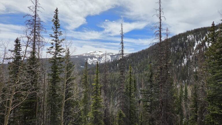
I am getting word of or communicating with several hikers who have gotten altitude sickness and have had to get off trail. It tends to happen right around when people are at Santa Barbara Campground or have just left Santa Barbara campground.
Altitude sickness is tricky, because it won’t just make you feel poorly. It may also affect your decision making. It can make you clumsy – thus making rough trail feel even rougher. And it can feel a lot like you’re just tired, or like you just got too much sun. Loss of appetite and nausea are also common symptoms.
All those things are uncomfortable, certainly, but it’s the decision-making impacts that could get you into the most trouble. Confusion, severe headache, and loss of coordination are the big red flags. If any of those things are happening, head down and seek medical attention asap.
Many things in life can be solved by just powering through. Altitude sickness is not one of them.
Stop if you feel dizzy, even a little dizzy. Staying hydrated, having realistic mileages per day, and giving yourself a day or two to adjust to the altitude are the best preventions. Stop, rest, hydrate, eat if possible, and reassess if you’re having symptoms. Do not continue higher if symptoms are worsening or not improving. If your symptoms don’t get better after some rest, you would do well to descend right then and there.
I’m working on getting an in-depth thing (video? blog post?) about altitude sickness and getting it reviewed by a board member who has decades of experience treating people who have altitude sickness. But those brief paragraphs are what I can give you for now.
A meaningful portion of the people doing the SF2T would do well to slow down. For medical reasons, if not for spiritual development.
Relevant Active Fires in Northern New Mexico
There are a few active fires, but none of them are near the route of the SF2T.
- The Macauley Springs fire in the Santa Fe National Forest is about 700 acres and currently at 63% containment as of the morning of July 3 per this Santa Fe National Forest Facebook post. The fire is about 40 miles west of the Santa Fe Plaza and the route of the SF2T.
- The Beehive fire in the Carson National Forest is 4,408 acres and currently at 11% containment as of the morning of July 3 per this Carson National Forest Facebook post. This fire is about 50 miles northwest from the route of the SF2T and Taos Plaza.