
July 25 Trail Conditions Update
- Fire and weather
- Carson no longer in Stage 2 restrictions
- Two very small fires
- Monsoons
- Water sources
- Rio Chiquito
- Rio Fernando de Taos
- Access
- Panchuela Campground
- Events at the Santa Fe Plaza
- Trail Work
- About the guidebook
- 10 copies at Taos Mountain Outfitters
- No copies at Travel Bug
- No backorders; we’re shipping copies 2-3 times a week
Frijoles Fire Update, 8/12, 12:17 pm
The Frijoles Fire has grown to 7,794.5 acres and is at 0% containment. Check for official updates here: https://www.Facebook.com/FrijolesFire or on Inciweb.
The air quality readings have improved for today, but they change constantly. Santa Fe Plaza is currently at 63 AQI per WatchDuty at the time of this update. That is in the Moderate category. Check for updates at https://fire.airnow.gov/ or via the WatchDuty app or other sources.
The weather forecast is promising. Cooler temperatures and increasing chances of rain are forecast later this week, although thunderstorms may also produce strong, erratic outflow winds.
If you are on trail in the area, have plans for exit points. Check fire activity at least every few hours. This is a fire that has added 1,500 acres since the last official update. Conditions can change very, very fast. It is irresponsible to be out in the backcountry near a fire like this and not have some way to monitor the fire’s behavior.
All that said:
a) The Santa Fe National Forest is still open.
b) The fire is still more than 5 miles away from the route of the SF2T. It is still roughly 5 miles northwest of Lake Katherine, but again – that could change at any time. It is your responsibility to be ready for that.
c) Great people are working hard to bring this fire under control. Read the full Facebook posts and incident reports for details. I am not an official or authorized source for fire information.
Get the app Watch Duty and monitor updates. Santa Fe County also has an excellent page, especially to monitor evacuation status and road closures. The Santa Fe New Mexican is publishing articles about the fire regularly.
Check the SF County Fire site for information on local evacuation statuses and road closures.
Update 8/12: There is confirmed water at La Cueva Field. Look in the undergrowth along the west side of the field. The creek is not actively running, but there are small pools of water.
Update 8/6 3:30 pm: The Frijoles Fire has grown to 200 acres. That’s 20x what it was less than 24 hours ago, which means this is a fire to pay attention to. If you are on trail, you should be thinking about exit points, though the Santa Fe National Forest is still open and no evacuations are active. But 20x growth in 24 hours warrants regular monitoring.
This is the latest from the Santa Fe National Forest’s Facebook page, which is where you should be checking (not here. I am not an authorized source of fire information). Or get the app Watch Duty and monitor their updates.
To excerpt that (just in case you can’t see the full post), from 2:19 PM, 8/6/26:
Espanola Ranger District
Frijoles Fire. Reported Date / Time: August 4, 2026 / 6:57 p.m. Cause: Lightning Size: 200 acres. Containment: 0%
Location: Steep terrain 5 miles west of Sierra Mosca, 3 miles southeast of Cundiyo, NM. The fire is within the boundaries of the Pecos Wilderness Area.
Personnel: U.S. Forest Service –Engine 461, Santa Fe Hotshots. Smoke Jumpers and multiple aerial resources.
Strategy: Direct extinguishment. Fire Behavior: High spread potential. Fuels: Ponderosa Timber, dead & down.
Operations: Fire fighters have established UTV access to the northeast of the fire. The Santa Fe Hotshots will begin building fireline on the northeast corner working east along the northern flank of the fire. Smoke jumpers will begin constructing helispots so that more equipment can can access the fire area. Large air tankers and helicopters will continue dropping retardant and water.
Smoke: May be visible from Santa Fe, Cundiyo, Nambe, Chimayo, Pojoaque, and Espanola.
Update 8/6 8:15 am: We’ve had two notable fires pop up in the last 48 hours. The 10-acre Frijoles Fire is burning about 10 miles northwest of Stewart Lake and the route of the SF2T. The Forest Service has multiple resources attending to the situation, including helicopters. A hotshot team was reported enroute yesterday and may be there already.
The Macho Fire is another 1.5 acre fire burning about 8 miles north of the village of Pecos and about 10 miles southwest of the route of the SF2T.
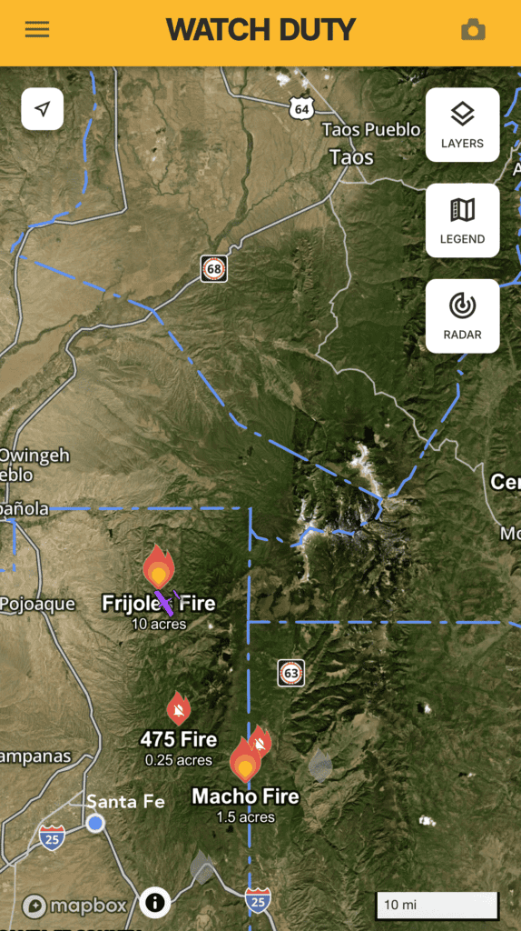
This is the latest update I’ve seen in a Facebook post from the Santa Fe National Forest. Note that this post describes fires across the Santa Fe National Forest that are not near the SF2T. The two that are worth monitoring for SF2T hikers (now, 8:15 am 8/6) are the Frijoles Fire and the Macho Fire.
As always, I recommend the app Watch Duty. It’s free and works remotely.
I am monitoring these fires, but I am not a fire professional. I will report developments here. It’s best to check the Santa Fe National Forests’ Facebook page. They post regular updates there.
Speaking only as an amateur and a hiker, I would not be alarmed by these fires. The Forest Service is taking action, they are very good at handling situations like this, and both fires are a considerable distance from the SF2T. Neither fire is growing rapidly, but that can change quickly. And you may see smoke. Check Watch Duty regularly, or be in communication with a ground contact who can check Watch Duty for you. “Be aware, not afraid.” Per the national weather service, there is rain expected Saturday in these areas and for several days after that.
Update 7/30: A recently deceased cow is right off Skyline Trail approximately one-third of a mile north of Pecos Baldy Lake. The Pecos Ranger station has been notified. The carcass may attract scavengers and predators, potentially increasing animal activity near this frequently used camping area. Keep dogs leashed and consider camping on the south side of the lake.
Update 7/28: Santa Fe National Forest rescinded Stage 2 fire restrictions as of 8am this morning.
Fire and weather
Carson National Forest rescinded Stage 2 Fire Restrictions on July 21
- “There are currently no local fire restrictions. Stage 2 fire restrictions were lifted at 6 a.m. on July 21, 2026” per the Carson National Forest Current Fire Restrictions and Related Prohibitions page. This Taos News article has more information.
- It had been in Stage 2 Fire Restrictions until July 21. Read the Carson National Forest Stage 2 order.
Santa Fe National Forest is still under Stage 2 Fire Restrictions.
Maestas and Borrego fires started July 24th
Two little fires have popped up in the last 24 hours. I’m monitoring them, but I personally am not overly worried about them. Here’s why:
- Both of these fires are small (2 and 3 acres) and 4-5 miles or more from the route.
- They started yesterday and haven’t grown overnight.
- We have been getting good monsoon rains so far. More are expected today and throughout the week. Winds are calm and expected to be for the rest of the week; about 5 miles an hour.
- The Forest Service has not updated their active fires page about these fires. They are very good about updating fire activity resources.
These two fires, given where they are, and given recent thunderstorm activity, are likely from lightning strikes. I don’t know that definitively, so understand that’s just a guess. Little fires like this are fairly common; most of the time they just burn out. We get more of them than most people realize. Given the gentle winds and rain activity, but even more the humidity that comes from even some local rains, these don’t look like something that’s going to grow significantly. They might even be out by this evening or tomorrow. That’s just my unprofessional, not-a-fire-fighter evaluation of things as they are right now. You are responsible for checking resources like Watch Duty, the Forest Service websites, and for calling ranger stations to check for updates.
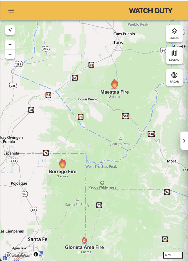
Get the app WatchDuty to monitor fire activity while you’re on trail.
It’s understandable to be a bit uneasy about these two fires, especially given the overall state of fire activity in the west this year (and in Florida). It’s always a good idea to have a plan in place to get off trail just in case conditions change on you quickly, whether that’s due to fire, injury, or something else. The SF2T has 13 outs for exactly this sort of contingency.

The monsoons have arrived
🥳
We are getting showers and thunderstorms daily across the area. Monsoon activity is fickle – one area can get drenched while barely a mile away it’s still dry – but there’s been enough activity that most areas have received at least one soaking rain. I was out on Forest Road 437 near Taos the day before yesterday and there were puddles for the first few miles off RT 518. In the shade, exposed ground was dark, holding at least a little residual water. We’re doing well. If this continues – and it’s expected to – the water sources will revive a bit. The fire risk is already drastically reduced, as Carson lifting fire restrictions confirms.
This was fun to see. It was recorded in the Pecos a few days ago:
Water sources
La Cueva Lake and La Cueva Creek are still assumed dry until I can check on them. 50 cent bet I can find water along La Cueva Creek now that the monsoons have started. Hoping to get out there soon.
Rio Chiquito is confirmed dry at the two campsites approximately opposite the entrance to Drake Canyon. It is wet, however, about 1,000 feet east of that.

From the campsites opposite Drake Canyon, the channel is dry for approximately 1,000 feet east/upstream before flowing water resumes. This is super interesting: Does it mean there’s another water source between the point cited above and where the dry spot is? Is it a spring? A rill coming down from the rather steep south side? Or are the beavers blocking the flow temporarily? (Do not blame the beavers if they are blocking this little flow. We’d have almost no water in Rio Chiquito without the beavers. It’s actually amazing to see so much water in Rio Chiquito given the snowpack and then the drought conditions. The beavers are saving our bacon along Rio Chiquito.)
I had been told by someone that it’s dry from Rio Chiquito to Taos. That’s not true: Rio Fernando de Taos is very low, but it is absolutely wet and absolutely a viable active water source.
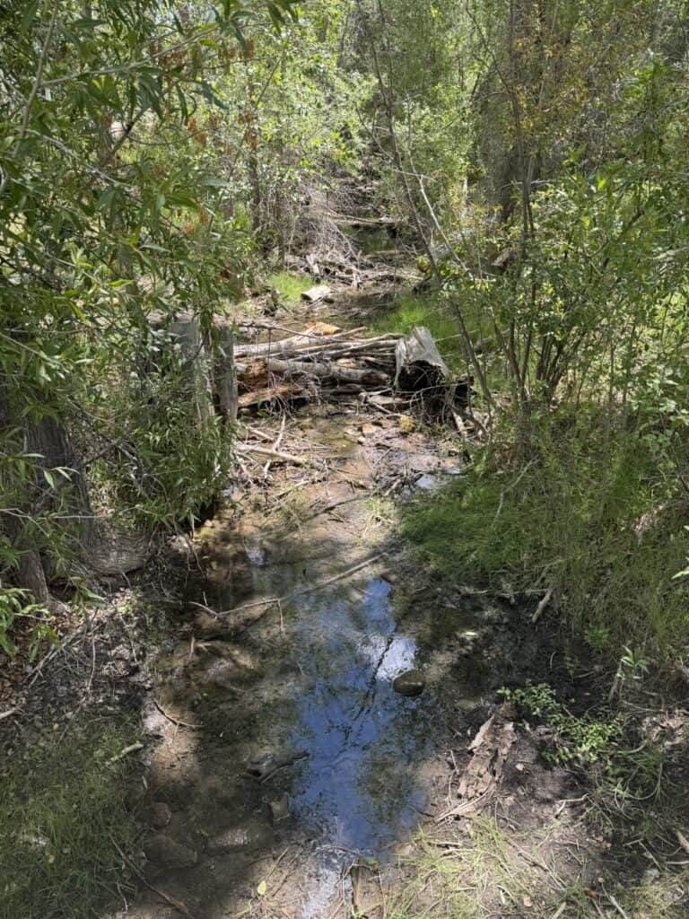
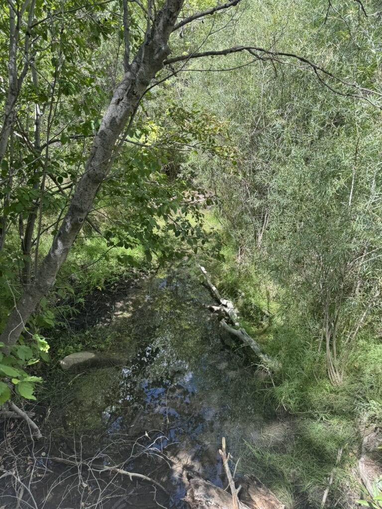
- Another thing to note about Rio Fernando de Taos at El Nogal: The warning about e coli has been taken down. Background: Amigos Bravos has a sign right past the bridge when you walk in from the parking lot. In prior years/months, that sign warned about the e coli levels. That warning has been removed. Just to be safe, I might still walk up river a few hundred feet to minimize the stuff in the water (that I would still not just treat the water here, but treat it twice, ’cause I’m like that). But the e coli hazard may have diminished here.
- One other thing this little creek highlights for me: How we treat the land and water matters. Having water available here is the result of how we treat or mistreat the land. Having to experience our impacts on the land directly, and over the course of a few days while we do the north half is an opportunity to directly experience the consequences of how we treat the land. We’re excellent at avoiding or ignoring or dismissing our impacts. Spending a few days in a real, unpolished and unDisneyfied landscape, with a real history and real use – not just another packaged recreational product of a trail – is an opportunity to change how we see and understand and treat the land. It’s an opportunity to change our relationship with it. Embrace that.
Access
Expect Santa Fe Plaza to be busy for the next few weeks
This weekend is Spanish Market, which has caused the entire plaza area to be mobbed. Indian Market will be August 15 and 16, and will cause the plaza to be even more mobbed. Things will quiet down dramatically after the second week of August, when most children go back to school. (You should all mutiny. The second week of August is way too early to forced indoors.)
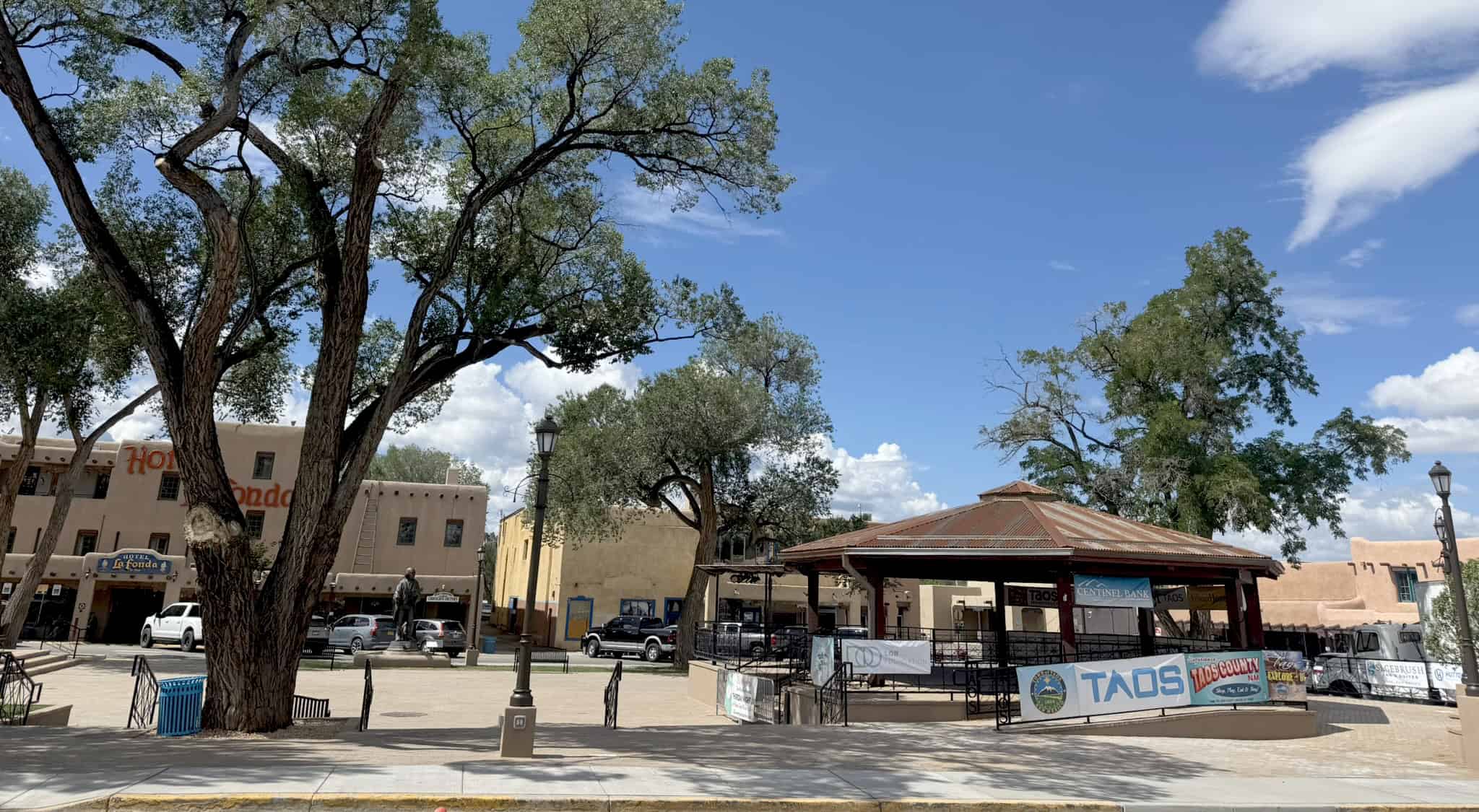
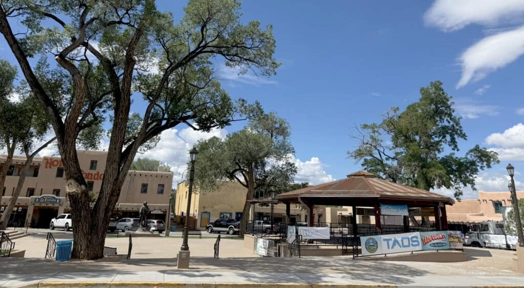
Taos Plaza and its gazebo are *finally* done
The Taos Plaza area has been under construction for about a year. The gazebo did get finished a few weeks ago. Then the plaza was closed again while the paving was redone. But they got it all finished by Fiesta de Taos, July 17-18.
It looks great. There will be music every Thursday evening until August 20 thanks to Taos Plaza Live.
Panchuela Campground is still closed
| Informal conversations with the Forest Service suggest that Panchuela could reopen within the next two or three weeks. That may be optimistic, but a mid-August opening is possible. |
| For now, the road to Panchuela is closed. It’s gated shut just after you pass Los Pinos Lodge. When I was there Saturday, I saw several day hikers park at or near Cowles and walk up the road, past Los Pinos and the gate, possibly continuing through to the trailhead and points beyond. |

Trail Work
NMWild will be clearing Skyline Trail from Pecos Baldy Lake to Horsethief Meadow, August 21-24.
If they get it cleared, this could be a long-desired alternate route for the SF2T. It’s what looks like the obvious way to go from the Cave Creek / Skyline intersection to Pecos Baldy if you’re only looking on a map. Of course, the map is not the territory. This little section of trail is kinda the poster child for that principle.
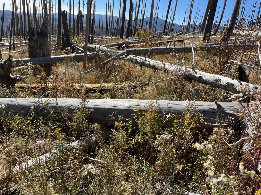
I used this section of Skyline Trail when I went through in 2018 (and have been on multiple times before and since). It goes through the 2013 Jaroso Fire burn scar. The trail has been getting easier as the downed trees slowly decay. When I went through in 2018, in addition to going over at least 100 downed trees in this 3-mile stretch, I also had to take off my pack and crawl under piles about 15 times. When I last went through in 2024, I only had to take off my pack and crawl under piles 2-3 times. The aspens are coming back here, too. There’s a little shade in spots under young aspens.
This bit of trail has caused quite a few incidents of hiker and trail runner consternation over the years. It will be really cool if NMWild can fully clear it, but I’m not sure four days is enough time to do it. Still – big crew, trained crew, plus a real concerted effort… they might pull it off.
7 bags of beer bottles and trash cleared from Forest Road 437
This is a vastly smaller effort than what’s about to happen on Skyline Trail, but I’m going to toot my own horn: I got 7 large bags of trash off Forest Road 437 and its campsites earlier this week. 90% of it was beer bottles, including so many broken glass beer bottles. There’s at least another 50 bags out there, but I’m hoping to just chisel away at it. I can’t build a new trail that runs parallel to Rio Chiquito, but just off the road enough for hikers to have a better experience yet. I don’t have the funding. Or the Forest Service approval. But I can pick up trash.
About the guidebook
The 2nd edition of the guidebook is not currently available at Travel Bug in Santa Fe (or anywhere in Santa Fe, at the moment).
It is available at Taos Mountain Outfitters. I dropped 10 copies off there the day before yesterday.
The guidebook is available here on the website. We are completely caught up with backorders and are shipping books two to three times a week. Stay tuned for an announcement about SF2T office hours, too…

Pam, you and I met at the Pecos River Earth Day Clean up back in April. I wanted to let you know (in case you are unaware), that the owners of Los Pinos Guest Ranch (Lodge) have had problems with folks parking on their property and hiking up to the Panchuela trailhead. I was told that they will have those vehicles towed if it keeps being a problem for them. Just thought I would give you a head’s up on that.