Update on the Hermit’s Peak/Calf Canyon Fire – June 5, 2022
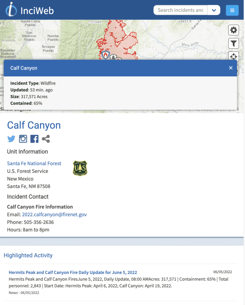
The fire has slowed considerably. It’s still burning, but as of this morning the fire crews have got it 65% contained.
We also have rain in the forecast, for a second week in a row:
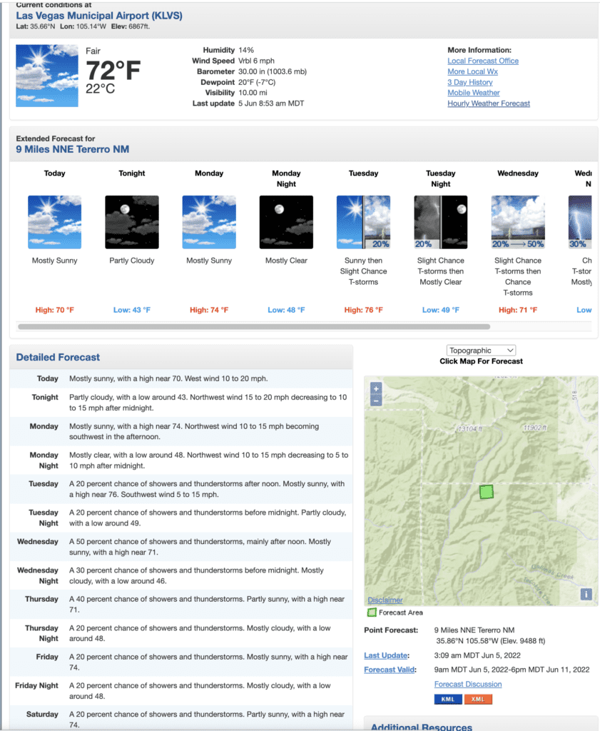
Despite the forecasts from last week, we got very little actual rain – 0.04 inches per NOAA’s three-day history tool.
But the fires are slowing down. That’s what matters. The 3,000+ people fighting just this fire have been making excellent progress. Still, we’re at nearly 800,000 acres burned so far this year, with the possibility of more fires flaring up almost anywhere at any time.
The President – Biden – is coming on June 11 to view the damage and hopefully offer a generous recovery package to make up for the Federally “supervised” prescribed burn that started this. We need all the help we can get.
Hiking this year could still happen, though anything near the fire really should stay closed. The woods and the wildlife need all the rest they can get. At least until the monsoon starts, all trails around Santa Fe and other sites are closed, though people are doing their usual thing and just ignoring the closure signs.
Status of the burn along the thru-hike
Ripley Point is still intact.
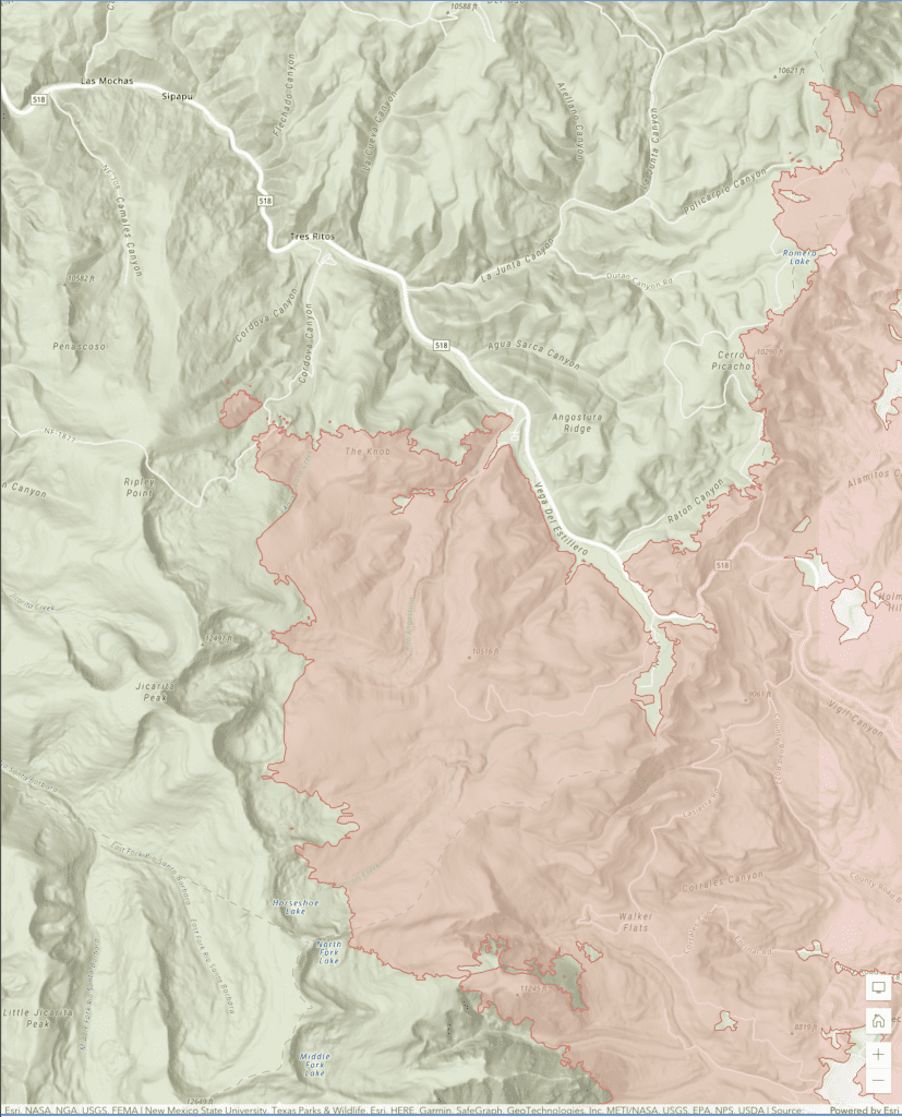
The map above, in the center left, shows Ripley Point unburnt as of today. There is also a road down from Ripley Point through Coldova Canyon to Tres Ritos. That route could be used to get around the burn that’s covered most of the southern part of The Knob and the way down from the Knob into Angostura.
You could continue the thru-hike from Tres Ritos through to La Junta Canyon (also known as FS 76) and avoid the fire completely. That’s the only way to go this year.
Next year it might be possible to go from Tres Ritos to walk along the road a little further and turn left up into Agua Sarca Canyon, which is the way I went when I first did the hike. The fire has reached the edge of Romero Lake and has just crossed the road I walked to get to Romero Lake (it’s a quiet road; I saw no one on it when I walked it), but anything that burned this year needs to rest through the winter before anyone can safely walk it.
Incredibly, that little bit is the only part of the thru-hike that’s burned so far (at least this year).
The fire is closer to East Pecos Baldy Lake than it was two weeks ago when I last posted, but much of the trails from Pecos (at least north and west of Pecos) are still intact.
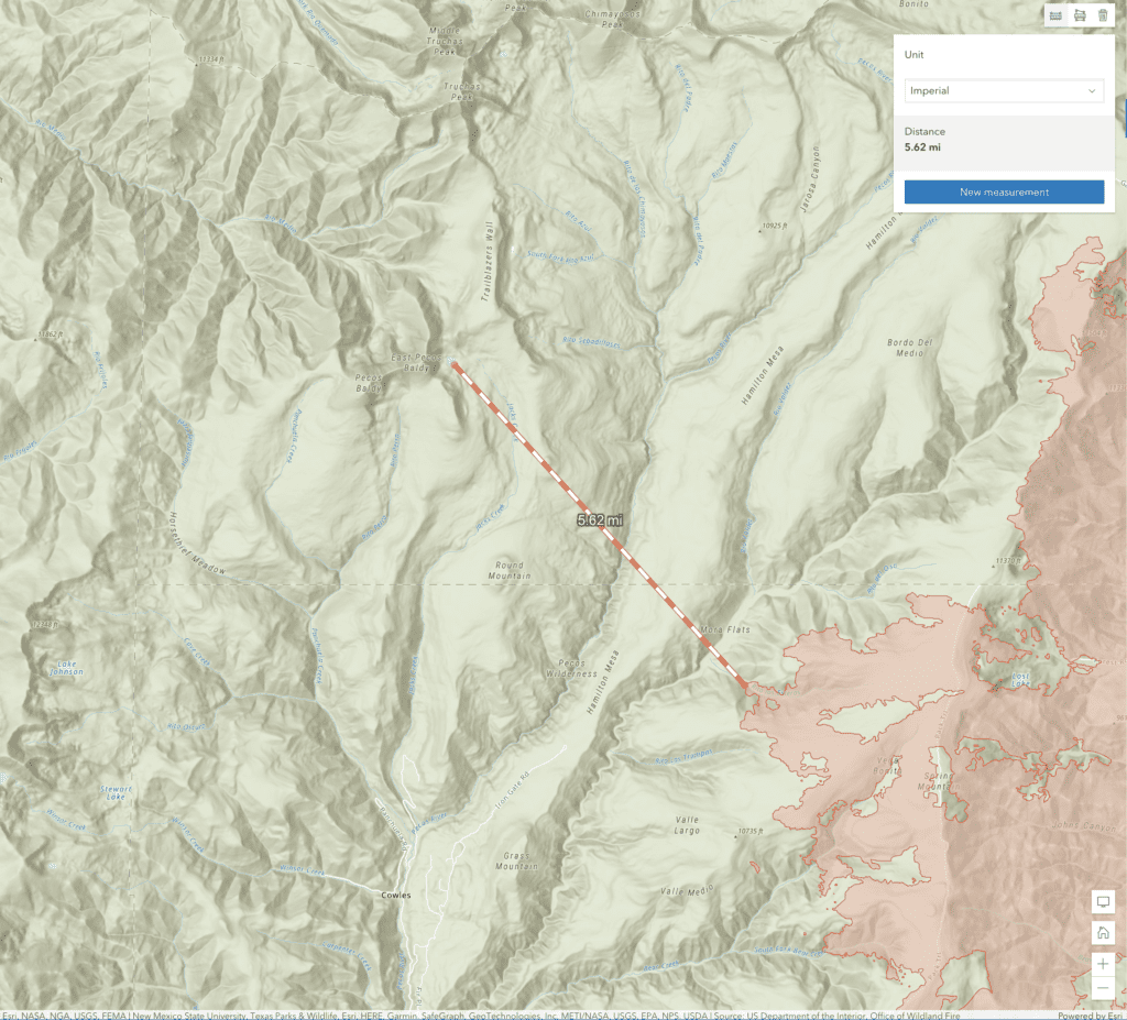
Here’s a closer view:
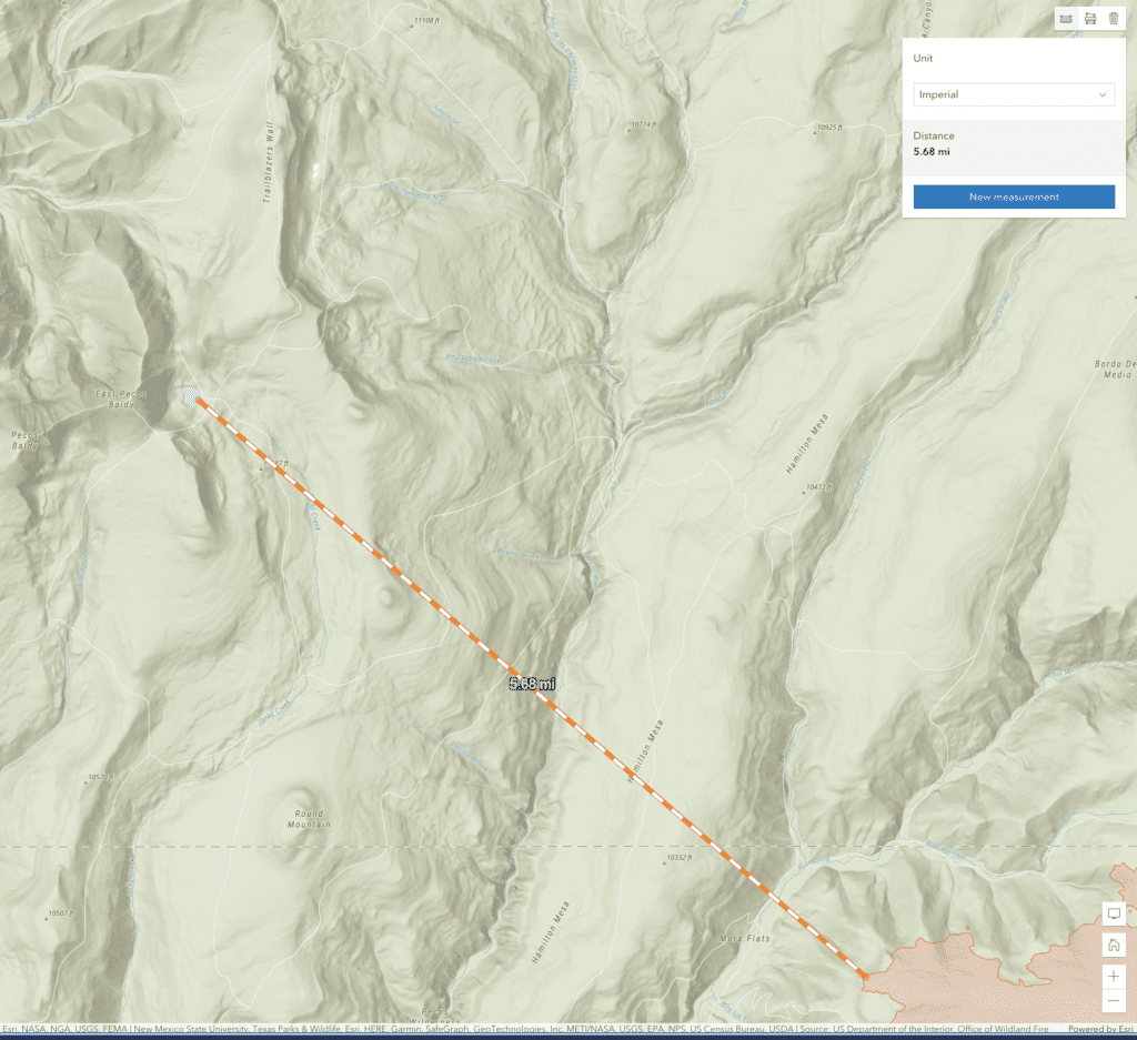
Note Round Mountain in the lower left-hand corner; that’s a landmark in the Pecos that hunters and hikers and search and rescue teams use as a reference point.
That’s it for me for now. Endless gratitude to the people fighting this monster, and to the teams yet to come that will help the eastern mountains recover from this.
The Santa Fe New Mexican has done a superb job covering many aspects of this story (I am proud to be a subscriber; consider supporting them). They have a good page on how to help people affected by the fires, or how to get help if you’ve been affected by the fires.
Also PLEASE consider donating to the Espanola Wildlife Center. Ask them what local charities they recommend donating to. The wildlife of these mountains needs every bit of help we can give.
