Section 4: Santa Barbara Campground to FR 442
- Santa Barbara to Los Estrellos 6.3 miles
- Los Estrellos to Agua Piedra Campground entrance/bridge 6 miles
- Agua Piedra Campground entrance to Trail 492 1 mile
- Trail 492 / La Cueva Canyon to FR 442 5 miles
18 miles section 4
Gaia maps (digitized step-by-step tracks) of this section are here.
Or click the Gaia map screenshot below and it will expand to full browser window. You can then zoom to different parts of the image.

Or check out my new map for section 4:
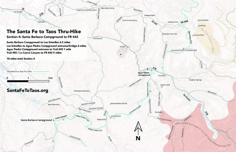
You can download this map for printing. It’s available in legal size (8.5″ x 14″, 21 MB) and in tabloid size (11″ x 17″, 29 MB).
Note that the campsites shown on the map above are not official campsites. But they are good places to put up a tent.
Overview of Section 4
Do follow the Gaia maps on your phone while you’re on the trail (the paid version of Gaia works without cell reception) but here’s the text version of the walk just for extra information.
- Start at Santa Barbara campground, near the hikers’ parking lots. You’ll see Rio Santa Barbara flowing by. Indian Canyon trail – trail #27 – has a marker on the far side of the creek. See the photo below in the slideshow for the exact spot.
- You will probably want river shoes to cross Rio Santa Barbara, unless it’s really, really low. Even in the dry season of 2018, just after the forests were closed during drought, I used river shoes to get across this. You could possibly just walk across in your bare feet, but there’s fishing done in this creek, and the rocks are not smooth. You’ll risk tearing up your feet right at the beginning of this section. I suppose if you had trail assistance (a really good friend) you could use river shoes to get across the creek, then toss the river shoes back to them across the creek so you wouldn’t have to carry them the whole way. Seems unlikely, though.
- However you get across it, once you’re across Rio Santa Barbara, you’ll go through tall forest until you get to a gate. Usually I’ve had to climb over or under this gate. Also expect to see cows (again) as you begin your climb up to “Bull Field” which I named simply because – can you guess? – Riley and I saw a very large but very chill bull here once.
- As you pass Bull Field and go back into the woods again, you’ll cross a very small creek (a rill, really). This is your last reliable water until you get to a very small creek (again, it’s a rill, technically. Is about 3 feet wide and very shallow) about 2.5 miles away. I would be carrying at least 2-3 liters of water from this point, but everybody has their way of doing things.
- From here you will climb up. A long way. You’re making your way to the top of Ripley Point, where you’ll join the Divide Trail for a little bit (not the Continental Divide trail, by the way… that’s about 100 miles west of you). There’s also a nice view of Jicarita Peak.
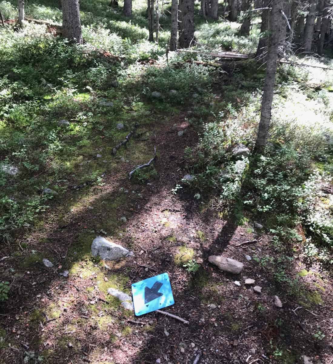
- The trail is very lightly traveled through here. As you can see in the slideshow below, there are bear around. There are mountain lions around. It’s mostly shaded, and while it doesn’t see much traffic, there arent too many fallen trees. Trail conditions are decent. You may see some strange markers along the way, but just enjoy them as points of interest and follow your gps and the Gaia maps.
- You’ll eventually get to trail 22A, the “Comales Trail” where you’ll start to go down. Fairly soon you’ll walk by Los Esteros, which is boggy, but very reliable water. I’ve camped here. It’s nice.

- As you continue down 22A you’ll come by water every few miles, then you’ll cross several creeks as you come into Agua Piedra campground, and pick up Trail 19A into the campground. This is a large campground, so expect to see horses tied up and don’t be surprised if you run into a few on your way down. It’s nice trail though – good shade, and water frequently enough to have no worries. There are many nice fields you could put up a tent in if you want to stop for the night before you get close to Agua Piedra and Tres Ritos. If you want an extra nice place to overnight, take the ~1.5 mile trail up to Indian Lake (the next best place to overnight is “La Cueva field, which is about 3.5 miles away).
- If you want, you might also be able to snag a ride or even walk 2 miles along 518 to the nearby Sipapu Ski complex. They rent cabins and rooms year round and have a restaurant, a store, and a little gas station. If you wanted to take a “zero day” or rest for a few days, Sipapu is your best, nearest option, though there are also cabins for rent near Tres Ritos.
- I have stayed at Sipapu, in one of their suites. It’s not fancy, but it’s very functional. They are okay with dirty hikers, and they are okay with even a group of dirty hikers staying in a suite. The kitchens are well-equipped with dishes and whatnot. The water is hot. The heat works well, though it’s loud. In addition to the king-sized bed in my suite, there were also four bunk beds. It was about $130 a night in the off season. They accept dogs in some units.
- Sipapu is also a resupply point. If you mail yourself a package to Sipapu (Sipapu Ski & Summer Resort, 5224 NM-518, Vadito, NM 87579), they will hold it for you. I would call ahead to confirm your package is there before you leave, but they have been doing this for hikers for quite a while now. They offer this service for free.

- Returning to the route instructions…You will come down into Agua Piedra on trail 19A, and then walk down to the entrance of the campground. There’s a bridge that runs over a 20 ft wide, strong creek – Rio Pueblo. You’ll be looking at Route 518. Sipapu is 2.4 miles to your left along 518. Tres Ritos, and La Cueva Canyon – where you’re headed, is 0.5 miles on 518 on your right.
- Fortunately, there is a lovely walk along Rio Pueblo for most of the way. The Gaia maps show the walks I did (back and forth) from the Agua Piedra bridge over to the entrance of La Cueva Canyon, and where you’ll pick up trail 492, la Cueva Trail. (Look for “S4-4 – Aqua Piedra bridge/entrance to La Cueva Canyon/Trail 492” on the Gaia maps. The slideshow below also shows photos of what this very short little walk looks like.

- Note that this mostly-along-Rio-Pueblo-walk also goes right by the parking for La Cueva Canyon and trail 492. You can’t actually park at the entrance of La Cueva Canyon – you have to drive towards Agua Piedra campground about one-quarterish of a mile and park at a small, paved paving lot. It’s mostly in the shade.
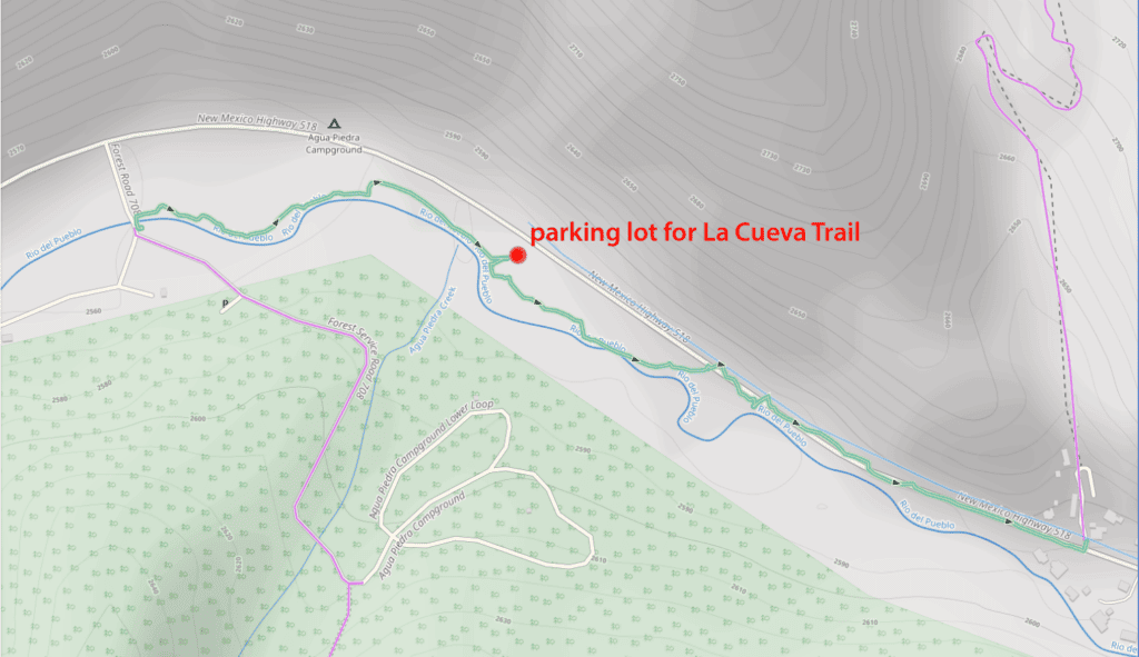
- From the entrance to La Cueva Canyon, you’ll go up a well-worn, very clear trail. There is a small creek that runs along it for the first 15 minutes or so. This is your last access to water until you get to La Cueva field, which is only about 1.5 miles away. La Cueva Lake is 2.4 miles away (but it’s a bit of a climb).

- From La Cueva Lake to Forest Road 442 (and where it would intersect with the La Cueva Trail, #492) is just 2 miles. So even if this is rough trail, there’s only two miles of it. There are also several documentations of trail 182 as a mountain biking trail. This is the best one. It describes the trail as “A 2-mile trail with several small stream crossings,” which is promising.
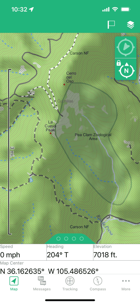
- Trail 182 also comes close to “The Pea Clam Zoological Area”. Apparently there is a “Sangre de Cristo Pea Clam,” and it has its own zoological area. I cannot make this stuff up. What’s strange is that handout, and the NM Wildlife site says the pea clam only exists in Middlefork Lake, near Wheeler Peak. This zoological area is nowhere near Wheeler, which is near the Taos Ski Basin, which is on the north side of Taos. Clearly, more research on the pea clam is required. If you find one, get excited, because apparently their last-reported siting was in 1991.
- Back to the route. Continue up Trail 182. You’ll cross 3-4 tiny creeks before you get to FR 442, but after 442 you’ll be without water for seven miles or so (unless you do the FR 442 alternate route).
- You will come out from either trail (492 or 182) at a gate, with Forest Road 442 just in sight. You have completed Section 4.
