Section 3: Pecos Baldy Lake to Santa Barbara Campground
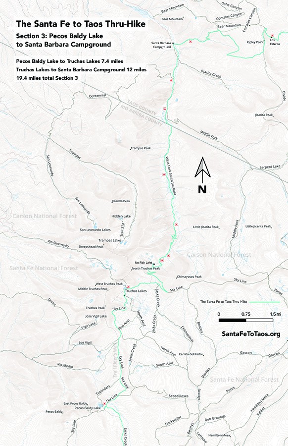
- Pecos Baldy Lake to Truchas Lakes 7.4 miles
- Truchas Lakes to Santa Barbara Campground 12 miles
19.4 miles total section 3
Gaia maps (digitized step-by-step tracks) of this section are here.
Or click the Gaia map screenshot below and it will expand to full browser window. You can then zoom to different parts of the image.

Or check out my new map for section 3:

You can download this map for printing. It’s available in legal size (8.5″ x 14″, 23 MB) and in tabloid size (11″ x 17″, 33 MB).
Note that the campsites shown on the map above are not official campsites. But they are good places to put up a tent.
Overview of Section 3
Do follow the Gaia maps on your phone while you’re on the trail (Gaia works without cell reception) but here’s the text version of the walk just for extra information.
- You start at Pecos Baldy Lake and pick up the Skyline Trail (251) north towards the Trailriders’ Wall.
- You will pass trail 257 (Jack’s Creek Trail), which veers off to the right. If you’re worried about lightning and are willing to give up the views from the Trailriders’ Wall, 257 is a legitimate choice. It runs approximately parallel to the Trailriders’ Wall until it gets to Rito Azul and Trail 263. The official SF2T stays on Skyline Trail and goes over the Trailriders’ Wall.
- The Skyline trail in this area is well-worn and clear. You’ll follow it up a slope and the views will open up.
- The Trailriders’ Wall is probably most accurately described as a long narrow mesa. There are stone piles along it, and some tree cover here and there. It’s a gradual climb up with views in all directions. Again, the trail is well-worn, and there are at least two trail markers along the way.

- You’ll come down off the Trailriders’ Wall and continue on the very long open high field along the still well-worn path. You will eventually get to a trail sign. Continue on Skyline Trail 251.
- You will walk alongside steep rocky slopes on your left, with dry evergreens and grasses on your right for the next bit, usually climbing, sometimes climbing quite a bit. You’re making your way up to Truchas Lakes. There will be a pond along the way that’s a good water stop, or possibly a place to stay for the night if you can’t quite make Truchas Lakes (though you are very close by the time you get to that pond).

- You’ll make one final climb up and finally be at Truchas Lake – the big lake. There is a smaller “pond”/lake less than 500 feet up from the main one, approximately north/northwest.
- There are plenty of good flat spots to put your tent, especially on the north side of the lake, which has larger trees and is a bit more sheltered. The weather up here, as in all alpine areas, can get intense. I’ve been up here once when the hail was so intense that if I hadn’t been under thick, sturdy trees, my tent probably would have been shredded.
- Hopefully you’ll get to stay the night here. It is an exceptionally nice place to be.
- Continuing on from Truchas Lakes, you’ll stay on Skyline for a bit and walk through mostly forested areas, with steep, impressive cliffs on your left again. There are fields and other good places to camp if you wanted them.

- There is the option of taking a shortcut along Trail 264 to go over the Divide. However, you would miss some of the most incredible views, and the trail is not as well marked or traveled or maintained.
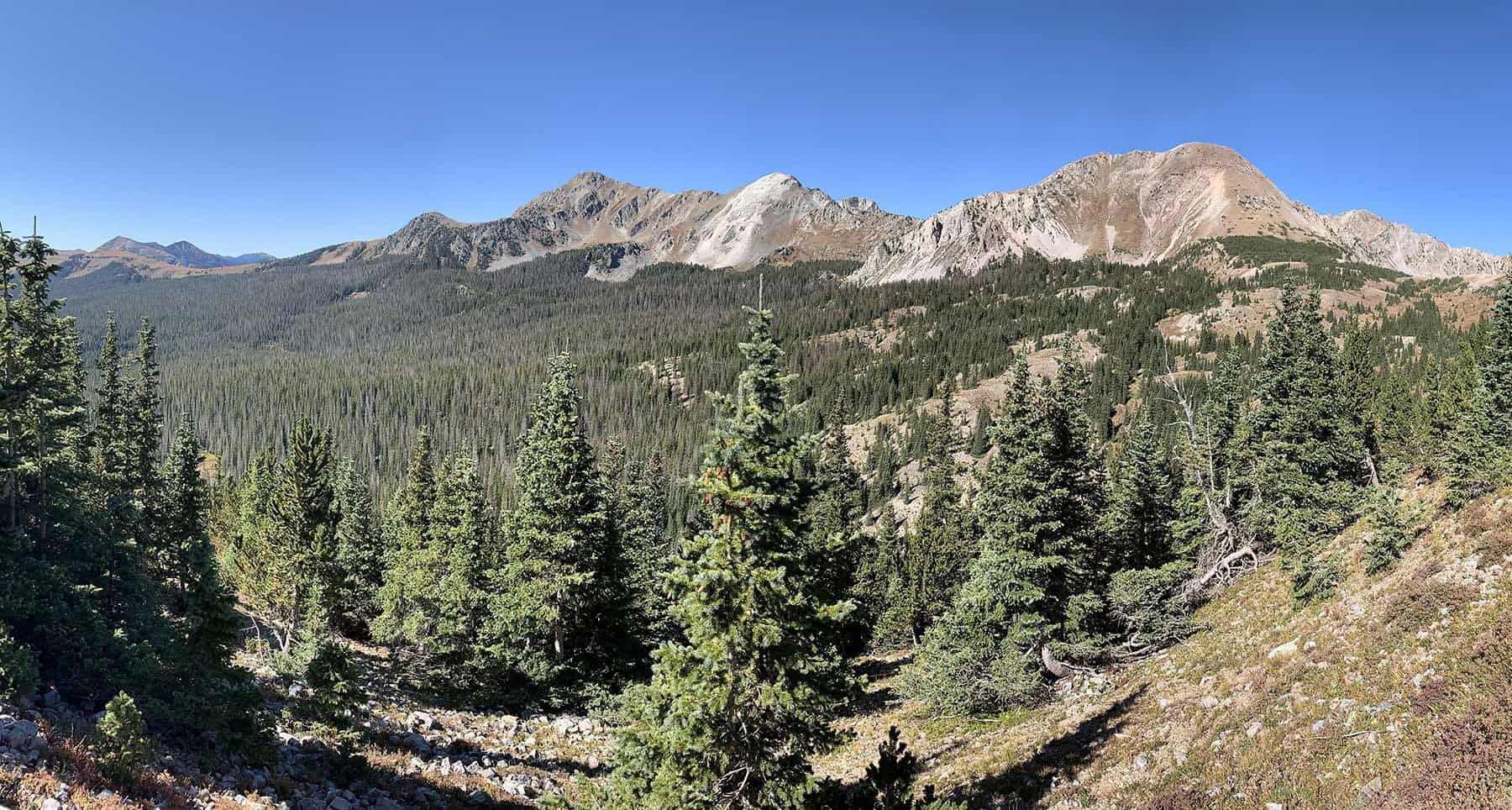
- When you hit Trail 25 (West Fork Trail) take it (leaving the Skyline Trail behind). From here you’ll begin the long, stunning walk and climb towards the Santa Barbara Divide. This has some of the most amazing views I’ve seen, including the Alps and the Colorado 14ers. There is some tree cover, but you should approach and go over the Divide in good weather, preferably in the morning. Once we are in monsoon season, there are almost always thunderclouds in the area in the afternoon.
- The trail up and over the Divide is very well-worn, with almost no fallen trees or erosion or other issues. There’s a trail sign at the Divide, but it’s pretty obvious – follow the one trail down.
- You’ll go down via a long switchback, over good trail but along a fairly steep slope. With a heavy pack on (and especially if you have an excited dog yanking on a leash back and forth), it can feel a little dicey. You’ll make it.
- The trail will bring you down under tree cover again soon enough, and you’ll pass by the lovely No Fish Lake on your left. If you needed a place to rest or get water or stay for the night, this is a good choice.
- As you go down and down and down towards Santa Barbara campground, there are plenty more campsites, and water at reasonable intervals. Again, if you wanted to stay overnight at one of these sites, it’s a good choice.
- You’ll also have more places to stay when you get to the very long, beautiful three-mile or so field along the way.
- The trail towards Santa Barbara is long, but it will go back under tree cover. You’ll cross the creek several times over new, well-built (if interesting) bridges.
- Eventually, after a very long walk from Truchas Lakes, you’ll walk into the far end of Santa Barbara campground. You’ll probably see a few campground people who have wandered into the woods for a bit as you approach it. YOu’ll come into Santa Barbara campground on the far end of it. Walk along either side of the loop, all the way to the other side of it to get to the parking lot for hikers. You will pass a source of potable water along the way.


