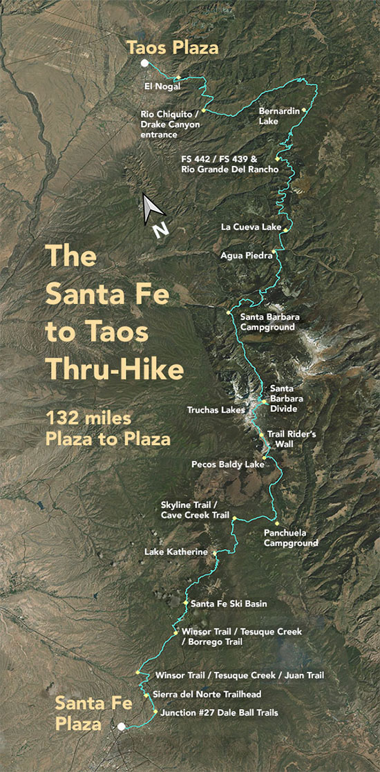
The Santa Fe to Taos Thru-Hike

The Santa Fe to Taos thru-hike goes from the Santa Fe Plaza all the way to Taos Plaza over the Sangre de Cristo Mountains. It is 132 miles long, spans four counties – Santa Fe, Rio Arriba, Mora, and Taos – and crosses the Santa Fe National Forest, The Pecos Wilderness, and Carson National Forest.
We have Gaia GPS maps documenting every step of the thru-hike.
Click here to download a printable version of the summary map above. The file is 1.7 mb, 300 dpi, and will fit on an 8.5 x 11 sheet of paper.
Here are a few of our favorite photographs:
Day 10 - Road from Bernardin Lake
Bernardin Lake is just behind this hill. Section 5 of the thru-hike is admittedly on a lot of forest service roads. I have driven most of them. You can drive to Bernardin Lake. Just don't try it without a four-wheel drive vehicle with relatively high carriage, and don't try it after, during, or right before heavy rain. If you are at all discouraged by bad roads, don't try it at all. Also, consider bringing a handsaw, as trees fall into the road and sometimes have to be sawed in half to move them. And bring water.

