13 x 19 Summary Map
$9.9913 x 19 summary map. Shipped rolled in a tube. Printed at 1,200 dpi on art paper.
Showing all 2 results
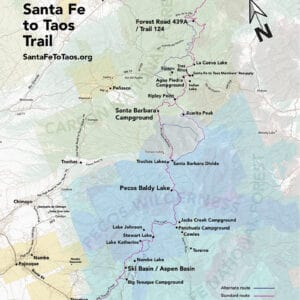
13 x 19 summary map. Shipped rolled in a tube. Printed at 1,200 dpi on art paper.

2026 route. 130 miles standard route plus 80 miles of alternate routes.
Can be imported into navigation apps like Gaia, AllTrails, OnX, CalTopo, Garmin, and others.
400+ waypoints along the Santa Fe to Taos Trail, from Santa Fe Plaza and Taos Plaza over the Sangre de Cristo Mountains.
Waypoints include:
Includes a tutorial for how to import the file into different navigation apps after you’ve purchased.
Read the use terms below before purchasing.
Want to get this file for free? Take the free, 30-minute online Leave No Trace 101 course and send us your completion certificate to contact@santafetotaos.org. We’ll send you access to the file.
Take the course, get the file. Learn more about why we’re offering this deal here.